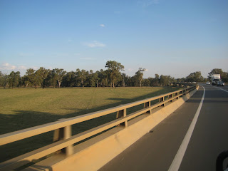
View Larger Map Left Wagga at around 9.30 - 10am, travelled out to Blamey Army Barracks, otherwise known as Kapuka a large barracks, whilst driving down the Hume Hwgy we passed Uranquinty Power Station - which is a 640MW gas-fired power station, comprising four Siemens V94.2 gas turbines. It is the second largest gas-fired power station in New South Wales, and is used during peak loads. Uranquinty Power Station was the fourth power station to be constructed by NewGen Power which was jointly owned by ERM Power and Babcock and Brown Power at a cost of $500 million dollars. On 4 July 2008 Babcock and Brown Power announced that it had sold the 640 megawatt gas-fired Uranquinty power station for $700 million to Origin Energy. On 19 January 2009 Origin Energy Limited announced that the Uranquinty Power Station was commissioned with eight people employed to operate the facility. Our first stop was over the New South Wales/Victorian border at the fruit fly station where we had to destroy all the fruit which was on this sign. Vic Roads have created large truck/traveller stops where they cater for cars towing caravans, semis etc the photos show how they have under shelter eating areas, toilets - but free camping not permitted. Hats off to Vic Roads - these are on the Hume Highway on which we were traveling. These photos are of Chiltern stop.
Friday, 12 April 2013
Wagga - Wangaratta (Victoria)
Total kms for this trip: 343km
View Larger Map Left Wagga at around 9.30 - 10am, travelled out to Blamey Army Barracks, otherwise known as Kapuka a large barracks, whilst driving down the Hume Hwgy we passed Uranquinty Power Station - which is a 640MW gas-fired power station, comprising four Siemens V94.2 gas turbines. It is the second largest gas-fired power station in New South Wales, and is used during peak loads. Uranquinty Power Station was the fourth power station to be constructed by NewGen Power which was jointly owned by ERM Power and Babcock and Brown Power at a cost of $500 million dollars. On 4 July 2008 Babcock and Brown Power announced that it had sold the 640 megawatt gas-fired Uranquinty power station for $700 million to Origin Energy. On 19 January 2009 Origin Energy Limited announced that the Uranquinty Power Station was commissioned with eight people employed to operate the facility. Our first stop was over the New South Wales/Victorian border at the fruit fly station where we had to destroy all the fruit which was on this sign. Vic Roads have created large truck/traveller stops where they cater for cars towing caravans, semis etc the photos show how they have under shelter eating areas, toilets - but free camping not permitted. Hats off to Vic Roads - these are on the Hume Highway on which we were traveling. These photos are of Chiltern stop.


Travelled through a small town called The Rock, it was so named as it stands under a large mountainous rock.
The railway line has been following the road for a long time, it is nice to see a line which is constantly used and not just for coal from mines to ports. Since leaving Wagga we have experienced smoke haze everywhere, found out that it is controlled burns by the Country Fire Association trying to stop the outbreak of bushfires in the future.
View Larger Map Left Wagga at around 9.30 - 10am, travelled out to Blamey Army Barracks, otherwise known as Kapuka a large barracks, whilst driving down the Hume Hwgy we passed Uranquinty Power Station - which is a 640MW gas-fired power station, comprising four Siemens V94.2 gas turbines. It is the second largest gas-fired power station in New South Wales, and is used during peak loads. Uranquinty Power Station was the fourth power station to be constructed by NewGen Power which was jointly owned by ERM Power and Babcock and Brown Power at a cost of $500 million dollars. On 4 July 2008 Babcock and Brown Power announced that it had sold the 640 megawatt gas-fired Uranquinty power station for $700 million to Origin Energy. On 19 January 2009 Origin Energy Limited announced that the Uranquinty Power Station was commissioned with eight people employed to operate the facility. Our first stop was over the New South Wales/Victorian border at the fruit fly station where we had to destroy all the fruit which was on this sign. Vic Roads have created large truck/traveller stops where they cater for cars towing caravans, semis etc the photos show how they have under shelter eating areas, toilets - but free camping not permitted. Hats off to Vic Roads - these are on the Hume Highway on which we were traveling. These photos are of Chiltern stop.
Cootamundra - Wagga Wagga via Junee
Total Distance travelled today
View Larger Map Our journey takes us along the Olympic Highway through Junee which is 53.3kms between Cootamundra to Junee. As we leave Cootamundra we experience very nice scenery, very green paddocks, as we are now in the Riverina area, paddocks of wheat which has been harvested recently. The plains are mainly crop growing with sheep. Junee is a medium sized town in the Riverina region of New South Wales, Australia. The town's prosperity and mixed services economy is based on a combination of agriculture, rail transport, light industry and government services, and in particular correctional services. In 2011 Junee's urban population was 4,400. We drove around Junee trying to find a tourist information centre, we eventually found it at the large aquatic centre, a little worse for ware as it did not have very much information at all about Junee. We did not find Junee a very attractive town, but also must say we did not spend much time in it. On our way again this time heading for Wagga Wagga where we will spend the night. Just a little out of Junee at the cross roads we found a small eatery called "Jail Break Inn" as we are getting closer to the countryside where Ned Kelly roamed and the owner has some relation to the Kelly gang he has set it up with some memorabilia which can be purchased from there. Whilst driving into Wagga Wagga we crossed over the great Murrumbidgee River. The Murrumbidgee River, a major tributary of the Murray River within the Murray–Darling basin, flows through the Australian state of New South Wales and the Australian Capital Territory; descending 1,500 metres (4,900 ft) as it flows 900 kilometres (559 mi) in a west-northwesterly direction from the foot of Peppercorn Hill in the Fiery Range of the Snowy Mountains towards its confluence with the Murray River near Boundary Bend. The word Murrumbidgee means "big water" in the Wiradjuri language, the local Aboriginal language. After crossing a rather long bridge as even though the river is not very wide now, but when the snow is melting it becomes a torrent hence the long bridge. We found a great caravan park on the banks of the Murrumbidgee - called Beach Front Caravan Park - it has a boom gate where a swipe card is required to gain vehicle access to the park. The cost for one night was $28, the showers were very good, lovely and hot with very good pressure.


View Larger Map Our journey takes us along the Olympic Highway through Junee which is 53.3kms between Cootamundra to Junee. As we leave Cootamundra we experience very nice scenery, very green paddocks, as we are now in the Riverina area, paddocks of wheat which has been harvested recently. The plains are mainly crop growing with sheep. Junee is a medium sized town in the Riverina region of New South Wales, Australia. The town's prosperity and mixed services economy is based on a combination of agriculture, rail transport, light industry and government services, and in particular correctional services. In 2011 Junee's urban population was 4,400. We drove around Junee trying to find a tourist information centre, we eventually found it at the large aquatic centre, a little worse for ware as it did not have very much information at all about Junee. We did not find Junee a very attractive town, but also must say we did not spend much time in it. On our way again this time heading for Wagga Wagga where we will spend the night. Just a little out of Junee at the cross roads we found a small eatery called "Jail Break Inn" as we are getting closer to the countryside where Ned Kelly roamed and the owner has some relation to the Kelly gang he has set it up with some memorabilia which can be purchased from there. Whilst driving into Wagga Wagga we crossed over the great Murrumbidgee River. The Murrumbidgee River, a major tributary of the Murray River within the Murray–Darling basin, flows through the Australian state of New South Wales and the Australian Capital Territory; descending 1,500 metres (4,900 ft) as it flows 900 kilometres (559 mi) in a west-northwesterly direction from the foot of Peppercorn Hill in the Fiery Range of the Snowy Mountains towards its confluence with the Murray River near Boundary Bend. The word Murrumbidgee means "big water" in the Wiradjuri language, the local Aboriginal language. After crossing a rather long bridge as even though the river is not very wide now, but when the snow is melting it becomes a torrent hence the long bridge. We found a great caravan park on the banks of the Murrumbidgee - called Beach Front Caravan Park - it has a boom gate where a swipe card is required to gain vehicle access to the park. The cost for one night was $28, the showers were very good, lovely and hot with very good pressure.
Young - Cootamundra
48.7 kms
As we left Young we encountered some very straight stretches, as we neared Cootamundra the countryside changed into green hills and paddocks. Cootamundra is a town and local government area in the South West Slopes region of New South Wales, Australia and within the Riverina. At the 2006 census, Cootamundra had a population of 5,579.[1] It is located on the Olympic Highway at the point where it crosses the Muttama Creek, between Junee and Cowra. Although it is by passed by the Hume Highway, its railway station is on the Main Southern line, part of the Melbourne-to-Sydney line.
Sir Donald Bradman AC, Australian cricketer universally regarded as the greatest batsman of all time was born in Cootamundra. The town pride in this fact is displayed in general signage and marketing material and the home where The Don was born is a fully restored visitor site open to the public 7 days per week.
Cootamundra is the home of the Cootamundra wattle (Acacia baileyana). Every year there is a large 'Wattle Time' Festival (which happens when the wattle starts to bloom) with an art show and festivities.
View Larger Map

View Larger Map

Drew standing on cricket pitch named after Don Bradman; Bradman's house where he was born both in Cootamundra + Cootamundra Wattle trees growing on the side of the road.
View Larger Map
View Larger Map
Thursday, 11 April 2013
Cudal - Young
137 km:
We took of from Cudal approx 9.30am today our journey will take us through Canowindra, Cowra, Young, Cootamundra, Junee to Wagga Wagga where we will be staying the night.
The journey took us over roads which we had aready taken, after Cowra we were on virgin territory, the roads were a little rough. The countryside was very dry with not a lot of feed for winter. Our first stop was Young which is a very pretty town with gardens etc. Did you know that Young is the Cherry Capital of Australia, they make cherry jam, wine, chutney, glace' cherries, dried cherries and so the list goes on....... Young is a town in the South West Slopes region of New South Wales, Australia and is the centre of Young Shire. At the 2011 census, Young had a population of 6,960.[1]
Young is marketed as the Cherry Capital Of Australia and every year hosts the National Cherry Festival. Young is situated on the Olympic Highway and is approximately 2 hours drive from the Canberra area. Young is situated in a valley, with surrounding hills. The town is named after Sir John Young, the Governor of NSW during 1861-7.


View Larger Map

View Larger Map
CUDAL CLOUDS
Subscribe to:
Posts (Atom)